Measuring what is left, and bringing back what we can.

REIA is Muskowekwan First Nation's ecosystem restoration and monitoring program. We work on the health of the water, the soil and the living things that depend on both, and we keep the record of whether it is working.

Treaty
1874
Treaty 4, signed 15 September at Fort Qu'Appelle
Lands
12,517 ha
Across three reserves after the 1993 land entitlement settlement
Members
2,070
Registered population as of 2022
Ecoregion
Aspen Parkland
Touchwood Hills Upland landscape area

The place

Aspen groves, fescue grassland, and thousands of small undrained basins.

Muskowekwan sits in the Touchwood Hills Upland, in the band of Aspen Parkland that runs between open prairie to the south and boreal forest to the north. The Nation holds three reserves: Muskowekwan No. 85 near Lestock, Last Mountain Lake No. 80A, and a share of the Treaty Four Reserve Grounds No. 77.

Underneath it is glacial till, which left the landscape pocked with undrained depressions. Those are the prairie potholes, and they are why this part of the world matters so much to waterfowl and shorebirds. The soils between them are black chernozems, among the most fertile in Canada, which is also why so much of the parkland was broken for crop.

Before that, this was a mosaic: aspen bluffs scattered through rough fescue grassland, bur oak along the river valleys. Some of that mosaic is still here. Most of it is not.
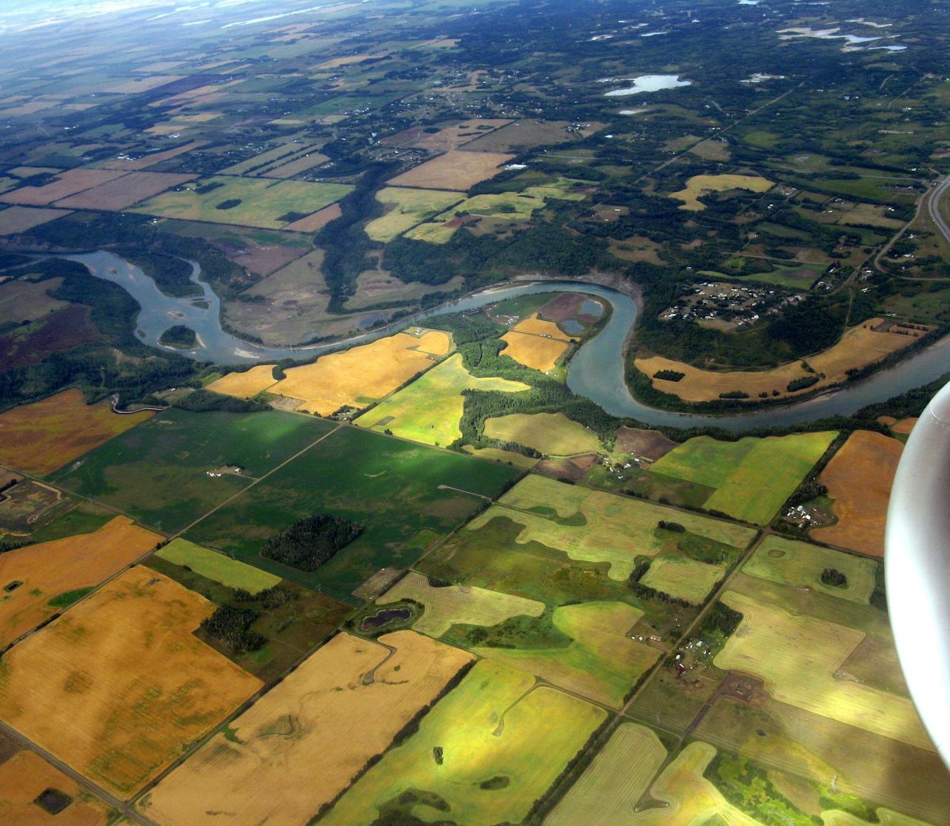
Aerial view of a river winding through aspen bluffs, cropland and small wetlands in late summer
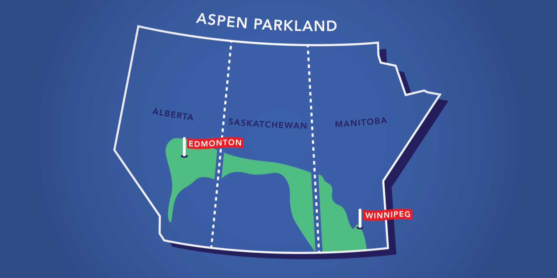
Map of Alberta, Saskatchewan and Manitoba with the Aspen Parkland shown as a green band arcing from Edmonton across central Saskatchewan and down to Winnipeg The Aspen Parkland, a band across all three Prairie Provinces between open grassland to the south and boreal forest to the north. Graphic: Jeff Robson, Spacing Edmonton.
What is changing

The losses are large, measured, and mostly not visible from a road.

Grassland is the most converted major ecosystem on the continent, and the species that depend on it have gone down with it.

67%
of Canada's grassland birds have disappeared since 1970.
Birds Canada
8.16M ha
of Aspen Parkland in Saskatchewan, 13 percent of the province, most of it now cultivated.
Saskatchewan Biodiversity
2 species
Chestnut-collared Longspur and Sprague's Pipit are at severe risk of disappearing entirely.
Birds Canada

Those numbers are national, and they describe exactly what has happened here. The parkland broken for crop took the fescue grassland with it. The wetlands drained to move water off farmland faster took the potholes. What is left is fragmented, and fragments hold fewer species than the same area held when it was whole.

Salinity compounds it. Across the prairies, clearing deep-rooted vegetation raised water tables and brought dissolved salts to the surface, leaving saline patches where little will grow. It is a slow problem and a reversible one, but only if something with deep roots goes back in the ground.

Water and salt

North of here, the largest saline lakes in Canada have nowhere to go.

The Quill Lakes are an endorheic basin. Water arrives and leaves almost entirely by evaporation, so the salt stays and concentrates. Since 2005, above-average precipitation has raised them by roughly seven metres. They now cover around 635 square kilometres, and they are close to overflowing the height of land into the Last Mountain Lake watershed.

That matters to this Nation directly. Muskowekwan holds reserve land at Last Mountain Lake. And Last Mountain Lake is not an ordinary prairie lake: the bird sanctuary at its north end, established in 1887, is the first federal bird sanctuary in North America, and a National Historic Site since 1987. More than 280 bird species have been recorded there, among them nine of Canada's threatened or endangered species including whooping crane, piping plover, burrowing owl and peregrine falcon.

A proposal to divert water out of the Quill basin through Kutawagan Creek drew a call for a hold from the Federation of Sovereign Indigenous Nations in 2015, and did not proceed. The underlying situation has not gone away.

We keep our own measurements so that when the question is asked, the answer already exists.

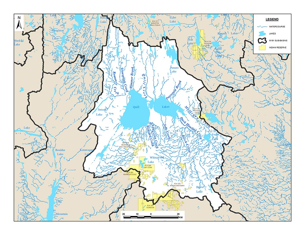
Map of the Quill Lakes watershed showing Big and Little Quill Lakes at its centre, the creeks draining into them, and First Nations reserve lands in yellow, including Muskowekwan on the southern edge The Quill Lakes watershed. Every creek drains inward and nothing drains out. Muskowekwan (IR 392) sits on its southern edge. Map: Quill Lakes Watershed Association.

The work

The work follows the year.

Water, soil, living things and climate are not separate problems here, and the field year does not divide them up the way a textbook does. The work is organised by season, because that is when each part of it is possible.

Ziigwan Spring
  • Melt and runoff sampling, when water is highest and salinity lowest
  • Migratory birds return, breeding surveys open
  • The native seeding window, short and weather dependent
Niibin Summer
  • Vegetation surveys at peak growth
  • Soil carbon and salinity plots resampled against baseline
  • Evaporation concentrates salt in the sloughs, so wetlands are watched closely
  • Youth out on the land
Dagwaagin Fall
  • Seed collected from the native stands that are still here
  • Shorebird and waterfowl staging counts
  • The last water round before freeze up
Biboon Winter
  • Snowpack measured, because it decides what spring runoff will do
  • The year's readings reviewed, checked and closed
  • Reporting to Council, and planning what next year's work will be

The year comes back around, and that is the unit of measurement. A single reading says almost nothing. The same reading in the same place over many turns of the seasons is what becomes knowledge.

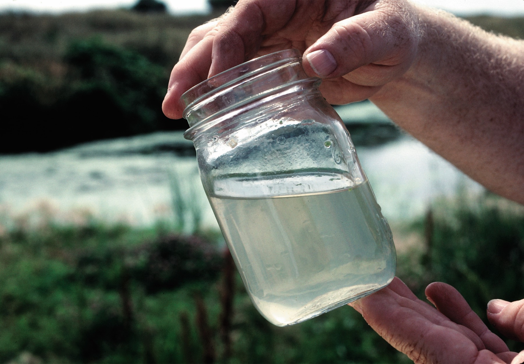
Hands holding a glass jar of cloudy water taken from a wetland, with the wetland behind

Restoration

Most of the recovery happens where nobody can see it.

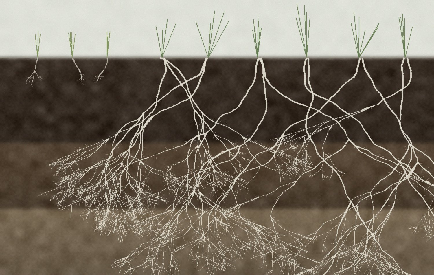
Soil profile comparing shallow rooted annual crops at left with deep rooted native prairie species at right

Annual crops root down a few inches. Native parkland species root down metres, and they build soil the whole way. That root mass is where carbon is stored, where water is held through a dry August, and where rising salt gets pushed back down.

So the work is unglamorous and slow. Native seed in the right places. Planting along water margins. Letting wetland edges recover instead of squaring them off. Then several seasons of waiting before the measurements say anything useful at all.

We publish methodology and we publish uncertainty. If a planting fails, the record says it failed. That is the only way a long environmental record is worth keeping.

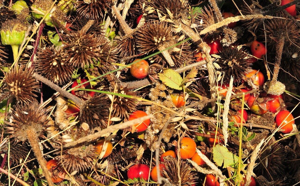
Hand-harvested native seed: bristly purple coneflower seed heads mixed with red wild rose hips
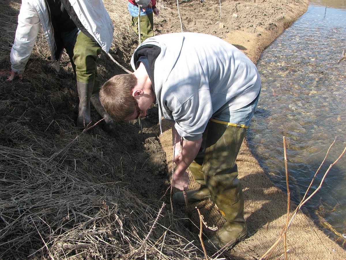
A person in rubber boots pushing a willow cutting into a freshly restored streambank beside clear water
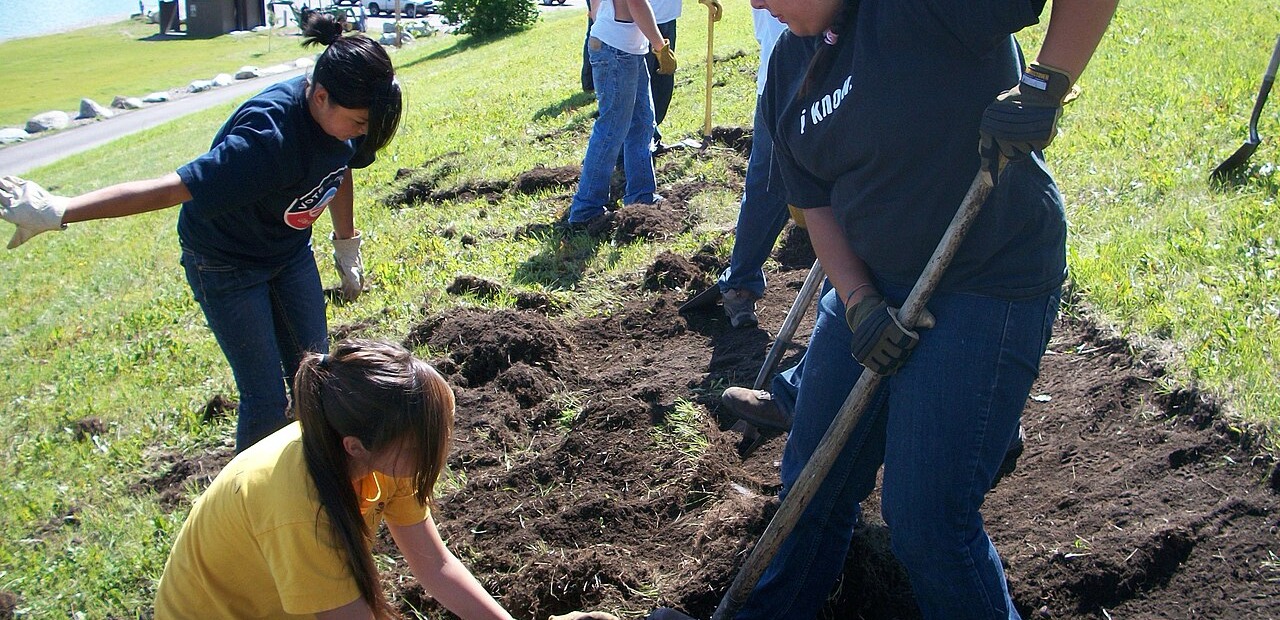
Young people in work gloves digging and planting on a grassy slope beside a lake

How we work

Public data first, field measurement always, honest about what we do not know.

Build the long baseline. Federal hydrometric and climate records establish what normal has looked like here across decades. That context is free, it exists today, and it is what lets a reading taken this spring mean anything at all.

Measure in the field. Guardians sample water, soil and vegetation on a seasonal schedule. Nothing enters the record without a person, a date and a location attached. Public satellite imagery fills in between visits.

Look ahead carefully. Climate inputs let us project conditions weeks out, which matters when planning a planting. Forecasts guide the Nation's own decisions. The work never declares water safe, and the absence of a warning is never an all clear.

Report what happened. Results are published against the baseline with method and uncertainty stated, including the results that did not work.

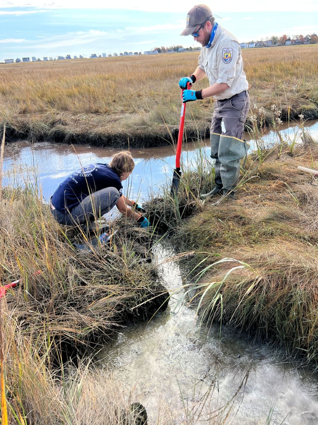
Two restoration workers in a tidal salt marsh, one kneeling at the edge of a shallow channel and one working a shovel into the marsh bank

Our data

This record belongs to Muskowekwan.

Environmental data about Indigenous land has a long history of being collected by outsiders and kept by them. This one is ours.

Ownership
The Nation owns the measurements, the records, and everything derived from them.
Control
Council decides what is collected and what is published. Nothing is released on the Nation's behalf.
Access
The record is for the Nation. Research requests go to Council, in writing, and are answered by Council.
Possession
Held on Canadian servers under written agreement, exportable in full at any time.

What is never collected or shown

  • Sacred and ceremonial sites
  • Burial locations
  • Harvesting and medicine grounds
  • Individual households
  • Individual member activity
  • Anything Elders ask us to leave alone

These are absent from the work entirely, not blurred and not hidden behind a login. A blurred marker still tells an outsider that something is there and roughly where. Traditional knowledge is never used as training data. It stays its own knowledge system, on its own terms, and it guides the work rather than being absorbed into it.

The people

Stewardship is a job, and the jobs should be filled from here.

Environmental work on First Nations land is too often done by contractors who arrive, sample, and leave with the data. The intent here is the opposite.

Stage one

Land based learning

Seasonal programs for youth, out on the land, learning what grows here and what is measured.

Stage two

Guardian training

Field protocol, sampling method, species identification, and the data discipline a long record depends on.

Stage three

Certification

Recognised technical credentials that hold their value anywhere, not only on this project.

Stage four

Paid technical work

Environmental technician roles with the Nation, running the programs rather than assisting someone else's crew.

Get involved

There are three useful ways in.

We are early, and we would rather talk to people now than present a finished thing later.

Learn more

If you are a member of the Nation, or you work in parkland ecology, wetland science, restoration or Indigenous environmental stewardship, we are glad to walk through what we are building.

Ask a question

Partner

We are looking for research partners in soil science, wetland and salinity work, and grassland restoration, and for other Nations doing this who want to compare notes without giving up ownership of the result.

Start a conversation

Support

Funding goes to native seed and planting, field equipment, Guardian wages and training, and the analysis that turns measurements into decisions. We can share a budget and what each stage costs.

Request the funding brief

Or write to us directly at info@reia.ca.

Sources for the figures on this page

  1. Birds Canada, Grassland Birds at Risk. Sixty-seven percent decline since 1970; Chestnut-collared Longspur and Sprague's Pipit at severe risk.
  2. Saskatchewan Biodiversity, Aspen Parkland ecoregion. 8,157,000 hectares, 13 percent of Saskatchewan, Touchwood Hills Upland landscape area.
  3. Quill Lakes: endorheic basin, approximately 635 square kilometres, risen roughly seven metres since 2005, at risk of overflow into the Last Mountain Lake watershed.
  4. Last Mountain Lake Bird Sanctuary, established 1887, first federal bird sanctuary in North America; National Historic Site of Canada, 1987; more than 280 recorded bird species.
  5. Indigenous Services Canada, Treaty 4 and Muskowekwan First Nation land and membership records; registered population 2,070 as of 2022.
  6. Federation of Sovereign Indigenous Nations statement on the proposed Kutawagan Creek diversion, 2015.